
Great aerial photography looks effortless on screen. A smooth glide over a landscape, perfect exposure across the frame, every important feature composed just right. What viewers don’t see is the meticulous planning that makes that effortlessness possible. The best aerial photographers in the business spend as much time preparing as they do flying – and that preparation is what separates consistently stunning work from hit-or-miss results.
The Pre-Flight Planning Mindset
Aerial photography begins not at the flight site, but at a desk, studying maps, satellite imagery, and weather forecasts. Before Skybound Views deploys for any aerial shoot, the team has already studied the site from multiple platforms, identified the key compositional angles, mapped the airspace restrictions, and built a primary and contingency shot list.
This pre-flight investment ensures that when the team arrives on-site, the mission is clear and the flight time is used efficiently. There’s no circling around trying to figure out what to capture – every flight path is deliberate.
Sun Position: The Single Most Important Variable
Experienced aerial photographers will tell you: the same location photographed at different times of day looks like two completely different subjects. Morning golden hour light raking across a landscape reveals texture and dimension that flat midday sun completely obliterates. Shadow direction at golden hour creates the depth that makes drone photography look cinematic rather than documentary.
Professional planning uses sun position calculators to determine the optimal flight window for any specific location and date. This isn’t guesswork – it’s applied physics translated into a flight schedule.
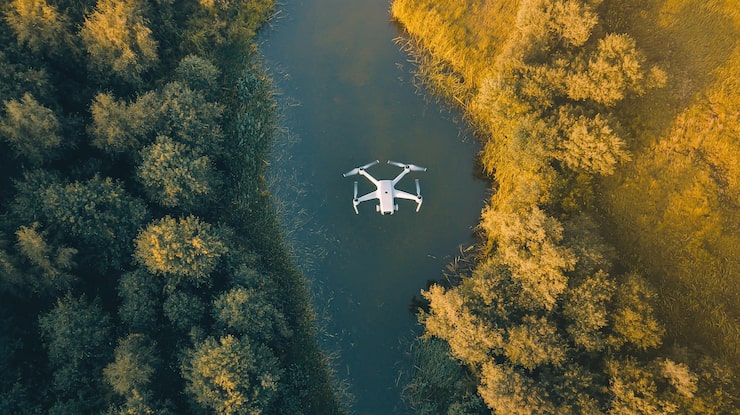
Altitude Strategy: Why Height Isn’t Always More
There’s a common misconception that aerial photography means flying as high as possible. In practice, the most compelling drone imagery often comes from medium altitudes – 100 to 300 feet – where architectural detail, landscape texture, and human scale elements remain visible. Ultra-high altitude shots tend to flatten everything into an abstract pattern that loses the context making the location meaningful.
The right altitude depends on what you’re communicating. Skybound Views uses altitude selection as a deliberate creative tool, not a default setting. The difference between 100 feet and 400 feet can be the difference between emotionally resonant content and technically adequate imagery.
Reading the Weather Like a Professional
Beyond the obvious (don’t fly in rain or strong wind), professional aerial photographers understand the subtle weather conditions that shape image quality. High thin clouds can act as natural diffusion panels, softening harsh midday light. Low overcast can eliminate shadows entirely, creating even-toned imagery ideal for technical documentation. Partial cloud coverage creates dramatic light and shadow contrast – beautiful for artistic shots but challenging for real estate photography that needs to show properties at their best.
Knowing which weather conditions serve which project types is part of what distinguishes professional aerial photographers from those who just wait for sunny days.
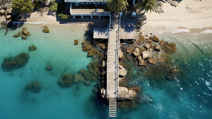
Compositional Principles That Apply 400 Feet Up
The fundamental rules of composition don’t disappear when you go aerial – they require new application. Leading lines in aerial photography are roads, rivers, shorelines, and property boundaries that guide the eye through the frame. The rule of thirds applies as much to an aerial landscape as to a portrait. Negative space – empty sky, open water – can be used powerfully to isolate subjects and create visual breathing room.
Skybound Views approaches aerial photography with the same compositional discipline as studio photography. The results look intentional because they are.
Equipment Calibration and Technical Settings
Even with perfect planning, aerial photography fails without proper technical execution. Camera settings must be tuned for the specific lighting conditions and motion parameters of each flight. ND filters manage exposure in bright conditions without requiring shutter speeds that create the ‘jello effect’ of rolling shutter on moving footage. ISO management balances sensitivity with noise performance across varying light conditions.
Post-processing workflows – color grading, lens correction, horizon leveling – complete the technical pipeline that turns raw aerial captures into polished, publication-ready imagery.
Conclusion
The aerial photography that looks effortless on screen represents hours of preparation, precision equipment operation, and skilled post-processing. Skybound Views brings this level of professional commitment to every aerial photography engagement – because great results don’t happen by accident. If you want aerial photography that consistently delivers, the planning starts before our drone ever leaves the ground.


Leave a Reply